To make sense of Lake Taupo history Maori culture and volcanic geology have to be read together, because here they are the same story. The lake fills the crater of one of the most powerful volcanic systems on Earth, and for centuries the people of Ngati Tuwharetoa have lived alongside it, naming its features and treating it as an ancestor. This guide walks through both: how the lake was made, who has cared for it, and what you can respectfully see and do today.

Taupo-nui-a-Tia: how the lake got its name
The full Maori name for Lake Taupo is Taupo-nui-a-Tia, usually translated as “the great cloak of Tia.” It commemorates the explorer Tia, one of the earliest Maori navigators to reach this inland lake. Tradition holds that Tia was travelling through the central North Island when he came to the eastern shore at Paka Bay. There he saw a marked lava cliff whose natural patterns and colouring resembled the rough shoulder garment he wore — a flax cape called a taupo, woven from alternating yellow and black leaves. He named the cliff Taupo-nui-a-Tia, and over time the name spread to the whole lake.
That naming tradition says a lot about how Maori related to the land — not as territory to be mapped, but as a record of journeys, ancestors and events. Each name carried a story, and knowing the story was part of knowing the place. The name is a thread back to the migration accounts that brought Maori to the heart of the North Island. If you want to go deeper on the names dotted across the map, our guide to the region’s geothermal attractions covers many of the same landmarks.
Ngati Tuwharetoa: the people of the lake

The iwi (tribe) most closely connected to Lake Taupo is Ngati Tuwharetoa, one of the major tribes of the central North Island. Their ancestral link to the region goes back more than 30 generations, and their traditional territory runs from Te Awa o te Atua (the Tarawera River) at Matata across the volcanic plateau to the country around Mount Tongariro and Lake Taupo.
Ngati Tuwharetoa traces its lineage to Ngatoroirangi, the tohunga (priest and navigator) who guided the Te Arawa waka (canoe) across the Pacific to Aotearoa. Ngatoroirangi is central to the tribe’s identity: he ascended the mountains of the plateau, named Tongariro and much of the surrounding landscape, and claimed the territory for his descendants. The tribe takes its name from a later ancestor, Tuwharetoa, who unified the region’s hapu (sub-tribes) into the confederation that exists today.
Traditional life on the lake
Early Ngati Tuwharetoa communities settled along the lakeshores and riverbanks, building pa (fortified villages) where they had access to fresh water, workable land and reliable food. The lake and its tributaries were rich in resources. Tuna (eels) were taken with elaborate weir systems in the inflowing rivers, and koura (freshwater crayfish) with woven traps. Kumara (sweet potato) grew in the volcanic soils, which were naturally warm and fertile — the geothermal heat that warmed the ground also extended the growing season and made cultivation possible at elevations that would otherwise be marginal.
The lake was a highway too. Waka were used for travel between settlements, for fishing and for keeping the scattered hapu connected. Its central position in the North Island made Ngati Tuwharetoa a geographically pivotal tribe, controlling movement between the east and west coasts and between the north and south of the island.
Ngati Tuwharetoa today
The Tuwharetoa Maori Trust Board administers the tribe’s interests today, including legal ownership of the bed of Lake Taupo — a fact that surprises a lot of visitors. The Crown owns the water and much of the surrounding land, but the lakebed itself belongs to Ngati Tuwharetoa, in recognition of their unbroken connection to this taonga (treasure). The tribe manages cultural protocols for the lake, maintains marae (meeting grounds) across the region, and plays a central part in the governance and environmental management of the Taupo catchment.
Ngati Tuwharetoa maintain an active cultural life. Gatherings at local marae bring families together for celebrations, tangihanga (funerals) and other significant events, keeping tikanga (customs), te reo Maori (the Maori language) and whakapapa (genealogy) alive for each new generation. Annual events such as Matariki celebrations draw iwi members, residents and visitors into shared observance.
The Taupo supervolcano: a geological powerhouse

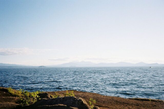
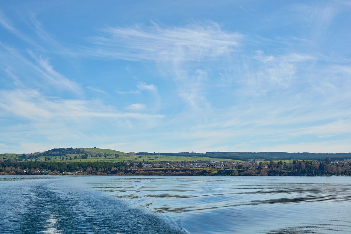
Lake Taupo exists because of one of the most powerful volcanic systems on the planet. The lake fills a caldera — a large volcanic crater formed by catastrophic eruptions — that covers roughly 616 square kilometres, making it the largest freshwater lake in Australasia by surface area. Knowing the forces that shaped it adds a lot to a visit.
The Taupo Volcanic Zone
Lake Taupo sits within the Taupo Volcanic Zone (TVZ), a belt of intense volcanic and geothermal activity that runs roughly 350 kilometres from Mount Ruapehu in the south to Whakaari/White Island in the Bay of Plenty. The TVZ exists because of a collision between two tectonic plates — the Pacific Plate is being forced slowly beneath the Australian Plate in a process called subduction. As the Pacific Plate descends into the mantle, rock melts and rises as magma, feeding the volcanoes and geothermal systems that define the zone.
The Taupo Volcanic Zone is one of the most active and productive volcanic regions in the world. It holds several active and dormant volcanoes, extensive geothermal fields, and a concentration of caldera-forming centres that is globally unusual. The geothermal features visitors enjoy at Craters of the Moon, Orakei Korako, Wairakei and the many natural hot springs are all surface expressions of this deep plumbing.
The Oruanui eruption: Earth’s most recent supereruption
About 26,500 years ago the Taupo volcano produced the Oruanui eruption — the most recent supereruption anywhere on Earth. It ejected an estimated 1,170 cubic kilometres of material (for comparison, the 1980 eruption of Mount St. Helens ejected about 1 cubic kilometre). The eruption buried a vast area of the central North Island under thick layers of ignimbrite (a rock formed from extremely hot, fast-moving pyroclastic flows) and ash.
The collapse of the magma chamber during the Oruanui eruption created the enormous caldera that later filled with water to become Lake Taupo. The scale is hard to grasp — roughly 100 times larger than the 1991 eruption of Mount Pinatubo in the Philippines, which by itself caused global climate disruption. The Oruanui eruption would have affected climate across the Southern Hemisphere and possibly beyond, though it happened long before people settled New Zealand.

The Hatepe eruption: around 232 CE
The most recent major eruption from Taupo occurred around 232 CE, known as the Hatepe eruption (sometimes the Taupo eruption). Smaller than Oruanui, it was still extraordinarily violent — one of the most powerful eruptions anywhere in the world in the last 5,000 years. It ran through a sequence of events: first a series of powerful explosions that built towering eruption columns, then a climactic phase that sent pyroclastic flows travelling at hundreds of kilometres per hour across roughly 20,000 square kilometres of the central North Island.
The eruption column is estimated to have reached 50 kilometres high — twice the altitude of a commercial airliner. Ash from the eruption has been found in ice cores from Antarctica, and Roman and Chinese observers recorded unusual atmospheric effects (vivid red skies) that may relate to it. The eruption largely emptied the lake, which then refilled over the following decades. The surrounding landscape was stripped bare, so the native bush visitors see today has all regrown since — making the forest around the lake less than 2,000 years old.
Is Taupo still active?
Yes, and it’s worth understanding. Taupo is classified as dormant, not extinct. Since the Oruanui eruption the volcano has erupted at least 28 times over the past 26,000 years. GNS Science (New Zealand’s geological research institute) continuously monitors the system with a network of seismographs, GPS stations, lake-level sensors and chemical sampling. The Volcanic Alert Level for Taupo is normally 0 (no volcanic unrest), though it has occasionally been raised to Level 1 during periods of minor seismic activity or ground deformation.
There’s no cause for alarm. The chance of a major eruption in any given year is very low, and New Zealand’s monitoring would give significant warning of any escalating activity. The ongoing geothermal activity — the hot springs, steaming vents and warm ground — is a gentle surface expression of deep volcanic heat, not a sign of an eruption on the way. You can read the current status any time on the GeoNet Taupo volcano page.
The Mine Bay Maori rock carvings

One of the most recognised cultural landmarks in the region is the Mine Bay Maori Rock Carving, now one of the North Island’s most visited attractions. It sits on a cliff face at Mine Bay on the western shore of Lake Taupo and is reachable only by water — by boat cruise, kayak or paddleboard from the Taupo Marina.
The story behind the carvings
The carving was created between 1976 and 1980 by master carver Matahi Whakataka-Brightwell and a team of four artists — Jono Randell, Te Miringa Hohaia, Dave Hegglun and Steve Myhre. The project began when Matahi paddled past a rock alcove at Mine Bay and had a vision of a tattooed face in the cliff. His grandmother, Te Huatahi Susie Gilbert, had long hoped for a likeness of her ancestor Ngatoroirangi to be made, and the vision matched her wish.
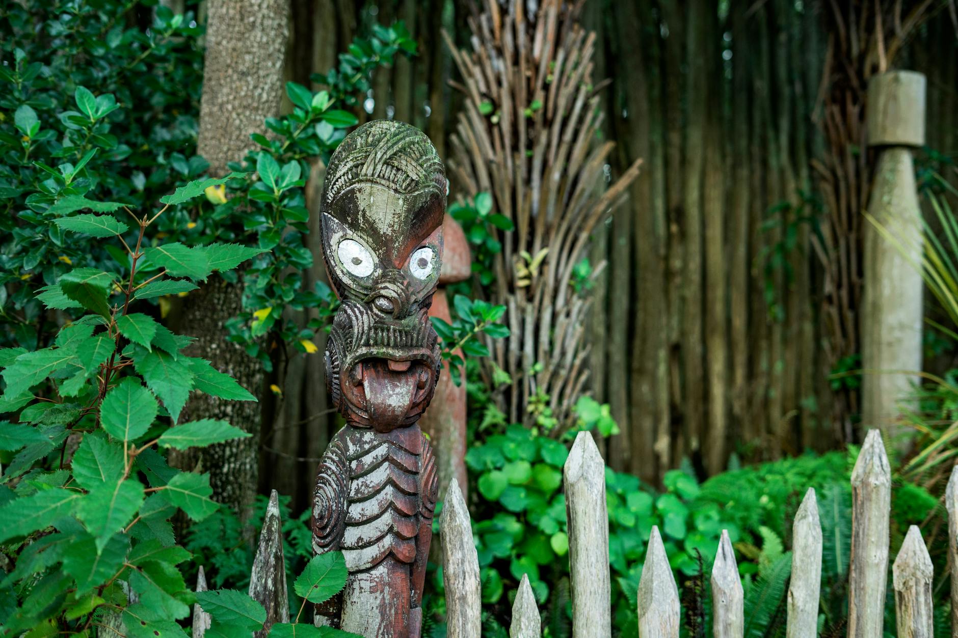
Over four years of painstaking work — much of it done from boats and scaffolding over deep water — the team carved a 14-metre depiction of Ngatoroirangi into the cliff. Around the central figure are smaller carvings of tupuna (ancestors) and kaitiaki (guardians) significant to the local iwi. It is regarded as one of New Zealand’s most remarkable pieces of contemporary Maori art, and a direct link between the deep past and the present.
Visiting the rock carvings
Several operators run boat cruises to the carvings from Taupo Marina, usually 2 to 2.5 hours. Kayak tours are a more active way to reach them, paddling across the lake and right up to the cliff face. Cruise prices generally run NZ$45–55 per adult, with children roughly half price, and family deals are available with most operators. The carvings are most dramatic in morning light, when the sun hits the cliff directly, though they’re impressive at any time. For the on-the-water logistics, see the Taupo adventure activities guide, and if you’re travelling with children the Lake Taupo with kids guide explains which cruise suits which age.
Tongariro National Park: sacred mountains

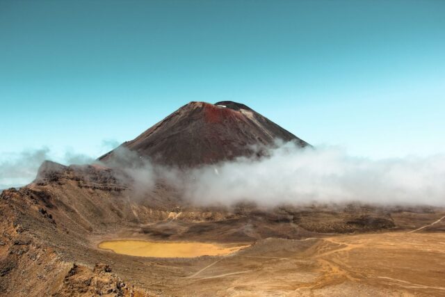
Just south of Lake Taupo rises Tongariro National Park, home to three active volcanic peaks — Tongariro, Ngauruhoe and Ruapehu — and one of New Zealand’s most culturally and naturally significant landscapes. Its importance was recognised internationally in 1990, when it was inscribed as a UNESCO World Heritage Site for its natural values, and again in 1993, when it became the first property in the world to receive dual World Heritage status as a “cultural landscape.”
The gift of Tongariro
The park has a remarkable origin. In 1887 the paramount chief of Ngati Tuwharetoa, Te Heuheu Tukino IV (Horonuku), gifted the sacred peaks to the Crown on the condition that they be protected as a national reserve. This — one of the earliest examples of indigenous-led conservation anywhere in the world — was driven by Horonuku’s determination to stop the mountains being divided and sold off by European settlers. By placing them under Crown protection, he sought to preserve their spiritual and physical integrity for future generations.
The park, established in 1894, was New Zealand’s first national park and only the fourth in the world. Today it covers 79,596 hectares and takes in the Tongariro Alpine Crossing, one of New Zealand’s Great Walks. For Ngati Tuwharetoa the mountains remain deeply sacred — not scenic landmarks but the physical embodiment of ancestral connection, spiritual power and tribal identity. Details on hiking that landscape sit in the Lake Taupo hiking and walks guide.
Dual World Heritage status
The 1993 recognition of Tongariro as a cultural landscape was groundbreaking. Until then, cultural World Heritage sites required built heritage — temples, monuments or structures — as evidence of their cultural use. Tongariro challenged that framework. Its cultural significance lies not in built structures but in the intangible spiritual, religious and cultural associations Maori hold with the landscape. The World Heritage Committee created a new category — “associative cultural landscape” — to accommodate this, and Tongariro was the first site inscribed under it.
Today Tongariro is one of only a small number of sites globally with dual World Heritage status for both natural and cultural values, placing it alongside sites such as Machu Picchu. You can read the official inscription on the UNESCO World Heritage listing.
Maori cultural experiences in the Taupo region

Visitors have several ways to engage directly with Maori culture in Taupo, through guided experiences, performances and hands-on activities. The most respectful ones are Maori-led, so the stories come from the people whose heritage they are.
The Haka Shop
The Haka Shop in Taupo runs Maori cultural experiences including evening performances with a hangi dinner, weaving workshops (where visitors learn about harakeke/New Zealand flax and make their own kete or basket to take home), cultural guided walks to Huka Falls, and kapa haka tutoring, where visitors learn the movements, chants and meaning behind traditional Maori performing arts. The experiences are led by local Maori guides who share their own connections to the land and its stories.
Wairakei Terraces
North of Taupo near Wairakei, this geothermal attraction combines natural hot pools with a night-time Maori cultural experience. The evening opens with a traditional welcome, followed by a guided walk through the geothermal grounds, and ends with a hangi feast prepared using traditional methods. The mix of geothermal scenery and Maori hospitality makes it a memorable evening.
Boat cruises with cultural commentary
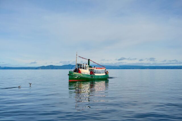
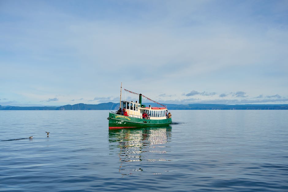
The cruises to the Mine Bay rock carvings are cultural experiences, not just scenic trips. Guides narrate the journey with accounts of Maori navigation, tribal history, the meaning of the carvings, and the relationship between Ngati Tuwharetoa and the lake. It’s an accessible introduction to the region’s cultural heritage, and an easy one to fit into the wider list of things to do around Lake Taupo.
Hangi: the traditional Maori earth oven

Any look at Maori culture in the Taupo region has to include the hangi — the traditional method of cooking food in an underground earth oven. The hangi is more than a cooking technique; it’s a social and cultural practice that has been central to Maori community life for centuries, and sharing one is a highlight of many trips to the region.
How a hangi works
It begins by heating volcanic stones in a large fire pit until they are extremely hot. A pit is dug, and the heated stones are placed at the bottom. Baskets of food — typically lamb, chicken, pork, kumara (sweet potato), potatoes, pumpkin, cabbage and stuffing — are wrapped in damp cloths or set in wire baskets and lowered onto the stones. The pit is covered with wet sacking and earth to seal in heat and steam, and the food cooks slowly for several hours, taking on the distinctive earthy, smoky flavour that hangi cooking is known for.
In the Taupo region the natural geothermal heat adds another dimension — in some places the ground itself provides supplementary heat, so the link between the volcanic landscape and the cooking tradition is especially direct. Several operators in and around Taupo offer hangi experiences, often combined with cultural performances, welcome ceremonies and storytelling. A hangi meal usually includes prime New Zealand lamb and chicken cooked in the earth oven, hangi-cooked vegetables, steamed mussels, fresh fish and traditional Maori bread (rewena paraoa). The Taupo food and dining guide has more on where to eat locally.
Te reo Maori place names around Taupo
The landscape around Lake Taupo is full of Maori place names, each carrying meaning that reveals something about the land’s history, its features, or the experiences of the people who named it. Understanding them enriches any visit and reflects the depth of the Maori connection to this country.
Taupo-nui-a-Tia (Lake Taupo) — “the great cloak of Tia,” named for the explorer Tia. Tongariro — named by Ngatoroirangi; often interpreted as “carried away by the south wind,” referring to the cold south wind that nearly killed him on the summit. Waikato — “flowing water,” the name of both the river that leaves Lake Taupo and the wider region; the Waikato is New Zealand’s longest river and begins at the lake’s outlet.
Huka (as in Huka Falls) — “foam” or “spray,” a fitting description of the churning white water. Ngauruhoe — the conical peak beside Tongariro, named after a companion of Ngatoroirangi. Ruapehu — commonly translated as “pit of noise” or “exploding pit,” apt for an active volcano. Tuwharetoa — the ancestor whose name the iwi adopted, loosely “of the standing house” or “of the firmly established house.”
Other significant names include Motutaiko (the small island in Lake Taupo, “the island of the adze”), Kuratau (“red adornment”) and Waitahanui (“great standing water”). Learning even a handful of these names and their meanings turns the landscape from scenery into story — a text written by centuries of Maori presence.
European settlement and colonial history

European contact with the Taupo region came relatively late compared with coastal parts of New Zealand. The first European recorded to reach the district was Andrew Powers in 1831, followed by the Anglican missionary Thomas Chapman in February 1839. Early settlement was largely mission-driven, with missionaries establishing churches and engaging with the local Maori population.
The Armed Constabulary era
The modern settlement of Taupo dates from 1869, when an Armed Constabulary post was established here. This military presence was a direct response to the New Zealand Wars of the 1860s, particularly the campaign of Te Kooti Arikirangi Te Turuki following his escape from the Chatham Islands in 1868. The colonial government saw the central North Island as strategically important and set up the Taupo post to secure inland routes and maintain order.
A redoubt (a type of fortification) was built by the Armed Constabulary in 1870 to guard a crossing of the Waikato River where it met Lake Taupo. The soldiers stationed there had roles beyond military duty — they built roads, bridges and telegraph lines, and that infrastructure gradually opened the region to wider settlement. The first hotels opened in the 1870s, and regular stagecoach services connected Taupo to Napier and Tauranga.
The rise of tourism
By the late 1870s and 1880s, the natural hot pools around Taupo were drawing visitors after the therapeutic benefits of geothermal bathing, and the tourism industry that would come to define the town began to take shape. The introduction of trout to the lake in the early twentieth century created a world-class sport fishery that pulled anglers from around the globe, cementing Taupo’s reputation. That fishery is still central to the town today, as the Lake Taupo trout fishing guide explains.
The twentieth century brought rapid development — hydroelectric power on the Waikato River, forestry in the surrounding Kaingaroa Forest, and the expansion of tourism infrastructure. Through all of it, the relationship between Ngati Tuwharetoa and the land and lake has stayed central, with the iwi maintaining an active role in governance, environmental stewardship and cultural preservation.
Geothermal heritage: where culture meets geology

The geothermal features of the Taupo region are where geological wonder and cultural heritage meet. For Maori, the geothermal activity was not simply a natural phenomenon but a manifestation of spiritual forces — the fire brought from Hawaiki (the ancestral homeland) by Ngatoroirangi, whose prayers for warmth while freezing on Mount Tongariro summoned volcanic fire from beneath the earth. This account explains, in Maori understanding, why the line of volcanic and geothermal activity runs from Whakaari/White Island through Rotorua and Taupo to the mountains of Tongariro.
Practically, geothermal activity shaped daily life in the region. Hot springs provided bathing and cleaning, naturally heated ground extended the growing season for kumara, and geothermal mud and minerals had medicinal uses. Cooking in geothermal steam and boiling pools — a precursor to the hangi tradition — was practised where the earth’s heat was accessible.
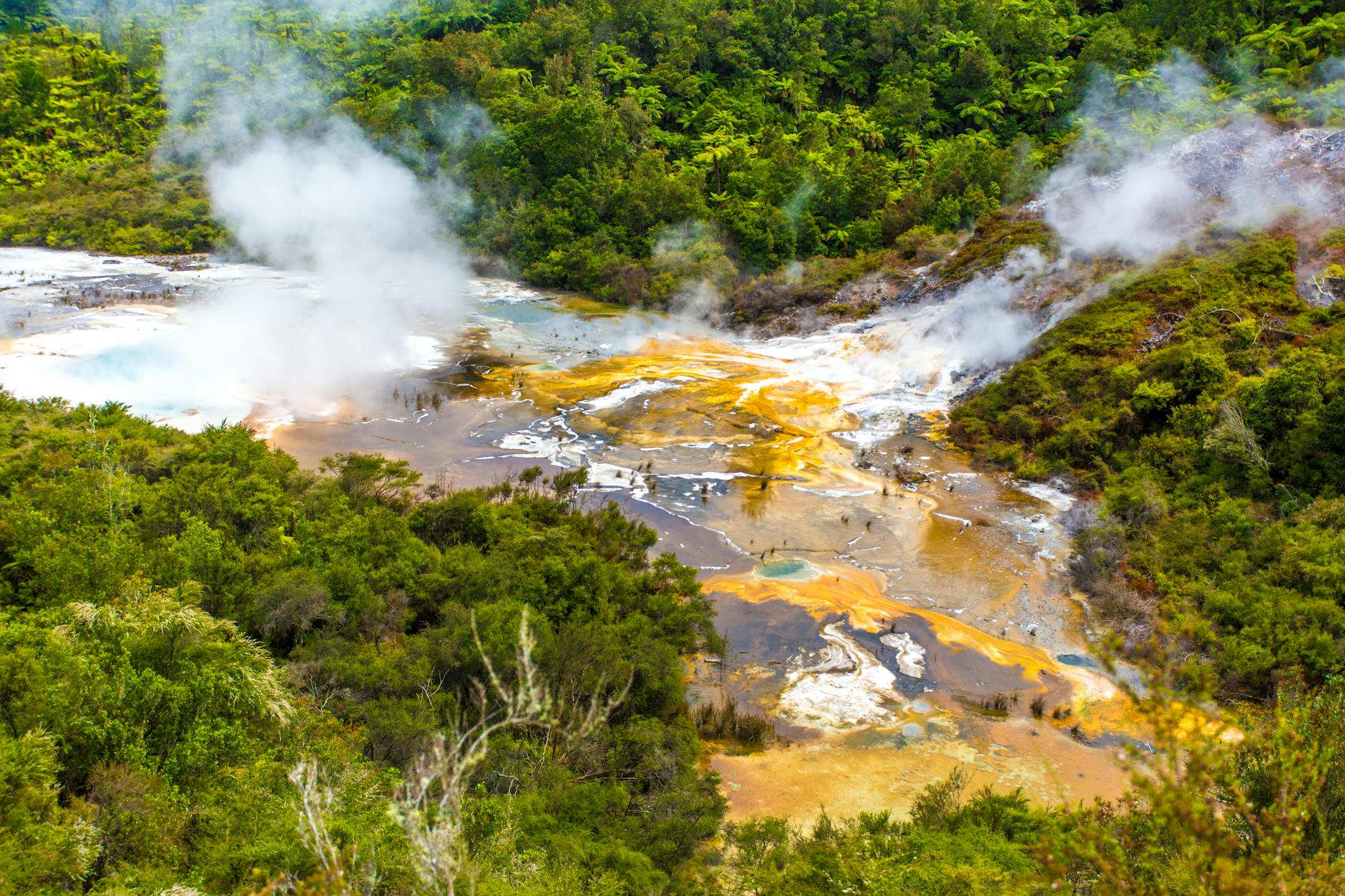
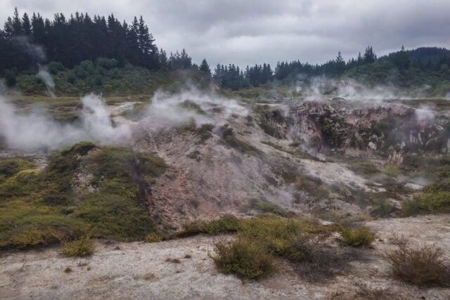
Today visitors can experience that heritage at many sites: Craters of the Moon offers an accessible walk through a steaming landscape, Orakei Korako (the “Hidden Valley”) holds some of the finest silica terraces in the world, Spa Thermal Park provides free geothermal bathing where hot streams meet the Waikato River, and Wairakei’s geothermal field shows how volcanic energy is harnessed for electricity. The full rundown is in the geothermal attractions guide, and it makes a natural pairing with the region’s best day trips.
Responsible tourism: respecting Maori culture at Lake Taupo
Visiting a place with deep cultural significance carries responsibilities. Respecting Maori culture, tikanga (protocols) and the spiritual significance of the landscape isn’t just courtesy — it makes for a better experience and helps keep this living heritage intact. A few guidelines for visiting the region respectfully:
Respect tapu (sacred) sites. Certain locations around the lake and in the surrounding landscape are tapu. These include specific sections of the lakeshore, historical pa sites, urupa (burial grounds) and areas of particular spiritual significance. If signage says a site is tapu or restricted, honour those boundaries. Do not climb on or touch the Mine Bay rock carvings — they are a living cultural treasure, not a prop.
Support Maori-owned tourism operators. Choosing Maori-led cultural experiences means the stories are told by the people they belong to, and the economic benefit flows to those communities. The Haka Shop, the Wairakei Terraces cultural evenings and many of the boat-cruise operators employ local Maori guides who bring personal connection and whakapapa to their storytelling.
Learn basic tikanga. A few simple things go a long way: learn the correct pronunciation of place names (ask locals if you’re unsure), understand that removing natural objects from culturally significant sites is inappropriate, and be aware that food should not be eaten at tapu sites. If you’re invited onto a marae, follow the protocols your hosts explain — particularly around removing shoes, following the powhiri (welcome ceremony) sequence, and the practice of hongi (pressing noses in greeting).
Follow lake protocols. Ngati Tuwharetoa has published cultural protocols for Lake Taupo that visitors should be aware of, covering water use, waste disposal and appropriate behaviour on and around the lake. The tribe’s view is that the lake is a living ancestor — treating it with the same respect you would show a person is the simplest way to understand what’s expected. New Zealand’s official tourism site, newzealand.com, has more on engaging respectfully with Maori culture.
Key cultural and heritage sites to visit
For visitors wanting to explore the cultural and volcanic heritage of the region, these are the sites worth prioritising:
Mine Bay Maori Rock Carvings — the 14-metre carving of Ngatoroirangi, reached by boat from Taupo Marina. An essential cultural experience; allow 2–2.5 hours for a cruise.
Craters of the Moon — a 45-minute geothermal walkway through steaming craters and vents that makes the volcanic forces beneath the landscape tangible. Family-friendly, small entry fee.
Tongariro National Park — a dual World Heritage Site with sacred volcanic peaks. The Tongariro Alpine Crossing is world-famous, but shorter walks such as Taranaki Falls are more accessible and still culturally significant.
Opepe Historic Reserve — a bush reserve holding the graves of nine Armed Constabulary soldiers killed in an ambush by Te Kooti’s forces in 1869. A sombre, historically significant site with a short, easy walking track.
Taupo Museum — small but excellent, with exhibitions on regional history, volcanic geology and Maori heritage. Entry NZ$5.
Orakei Korako (Hidden Valley) — arguably the finest geothermal attraction in the region, with silica terraces, geysers and a cave holding a warm jade-green pool. About 25 minutes north of Taupo.
Spa Thermal Park — free geothermal bathing where the Otumuheke Stream meets the Waikato River, with cultural and geological significance. If you’re planning a longer trip, our Ultimate Backpacking Guide to Lake Taupo ties these sites into a full itinerary, and the 3-day Lake Taupo itinerary shows one way to string them together.
Maori legends and mythology of the Taupo region
The landscape around Lake Taupo is saturated with mythology that explains its natural features through ancestral experience and spiritual understanding. For Ngati Tuwharetoa these stories are not folklore — they are history, genealogy and navigation woven into one.
The most significant figure associated with the region is Ngatoroirangi, the tohunga who navigated the Te Arawa waka to Aotearoa. According to tradition, he climbed the summit of Tongariro to claim the surrounding lands for his people. At the summit a ferocious south wind (the tongariro, “carried by the south wind,” which gave the mountain its name) struck him and he nearly froze to death. In desperation he called out to his sisters in Hawaiki for help. They sent fire through the earth, which burst forth at Whakaari/White Island, then at Rotorua, and finally at Tongariro, saving his life. This fire — which Maori understand as the volcanic and geothermal activity that defines the Taupo Volcanic Zone — is the spiritual origin of all the hot springs, geysers and volcanic peaks from White Island to Ruapehu.
Another tradition concerns the creation of the lake itself. In one account, Ngatoroirangi hurled a totara tree into a barren dust bowl to bring life to the area. The west wind blew the tree off course and it landed upside down, branches piercing the earth. Fresh water welled up through the holes the branches made, gradually filling the basin to form Lake Taupo. Geologists explain the lake’s formation through caldera collapse, but the Maori narrative captures a deeper truth — the lake’s existence is bound up with the volatile forces beneath the surface.
Motutaiko, the small island in Lake Taupo, features in several traditions as a place of refuge and spiritual significance. Its name means “the island of the adze,” and it served historically as a food storage site and a retreat in times of conflict. It remains a culturally significant landmark, visible from many points around the lakeshore.
The living volcanic landscape today
The volcanic heritage of the Taupo region isn’t confined to history books — it’s visible, tangible and in places still actively evolving. You can experience it at dozens of sites around the region.
The Aratiatia Rapids, downstream from the dam on the Waikato River, put on a daily demonstration of the river’s power. At set times each day (typically 10am, 12pm and 2pm, with an additional 4pm release in summer) the dam gates open and the dry riverbed becomes a thundering torrent within minutes. Viewing platforms along the bank give dramatic vantage points. It’s free, and a vivid reminder that the forces shaping this landscape are anything but idle.
The Wairakei Geothermal Power Station, visible from State Highway 1 north of Taupo, was one of the first geothermal power stations in the world when it began operating in 1958. Today it generates enough electricity for roughly 150,000 homes, drawing on the same volcanic heat Maori have used for cooking and bathing for centuries. The nearby Wairakei Terraces feature human-made silica terraces created by channelling geothermal water over specially built surfaces, echoing the famous Pink and White Terraces destroyed by the 1886 Mount Tarawera eruption.
For a deeper geological grounding, the Volcanic Activity Centre (associated with the Taupo Museum) has interactive exhibits on the Taupo Volcanic Zone — earthquake simulators, eruption models, and clear explanations of the monitoring systems that keep watch over the region. It’s good context for everything else you’ll see around the lake, and easy to reach using the Taupo transport guide.
A landscape of stories
Lake Taupo is a place where the past isn’t hidden — it’s written into the landscape. The caldera that holds the lake tells a story of enormous volcanic power. The carvings at Mine Bay tell of ancestral journeys and spiritual guardianship. The place names across the map speak of explorers, events and the deep Maori understanding of the land. And the living traditions of Ngati Tuwharetoa — their tikanga, their kaitiakitanga (environmental stewardship), their whakapapa — show that this heritage is not a museum exhibit but an active, evolving cultural force.
Whether you’re watching steam rise from geothermal vents, cruising across the lake to the rock carvings, learning a waiata (song) at a cultural performance, or simply standing at the edge of this vast body of water and thinking about the forces that made it, you are engaging with a story that stretches back millennia. Take the time to listen, learn and respect. When you’re ready to plan the rest of your visit, the Things to Do in Lake Taupo guide is a good place to start.
Frequently asked questions
What does the name Taupo mean?
The full name is Taupo-nui-a-Tia, usually translated as “the great cloak of Tia.” It commemorates the explorer Tia, who named a marked lava cliff at Paka Bay after his flax shoulder cape (a taupo). Over time the name came to apply to the whole lake.
Which iwi is connected to Lake Taupo?
Ngati Tuwharetoa is the iwi most closely associated with the lake, with an ancestral connection going back more than 30 generations. The tribe legally owns the bed of Lake Taupo and plays a central role in managing the lake and its catchment.
Is the Taupo supervolcano still active?
Yes, Taupo is classified as dormant rather than extinct, and has erupted at least 28 times in the past 26,000 years. GNS Science monitors it continuously, and the Volcanic Alert Level is normally 0. The probability of a major eruption in any given year is very low, and monitoring would give significant warning of any escalation.
How do you see the Mine Bay Maori rock carvings?
The 14-metre carving of Ngatoroirangi is only reachable by water. Boat cruises from Taupo Marina run about 2 to 2.5 hours and cost roughly NZ$45–55 per adult, with children about half price. Kayak and paddleboard tours are a more active alternative, and morning light shows the carving at its best.
How can visitors respect Maori culture at Lake Taupo?
Treat the lake as a living ancestor. Don’t touch or climb the rock carvings, honour any signage marking tapu or restricted sites, learn the correct pronunciation of place names, and choose Maori-led cultural experiences so the stories are told by the people they belong to and the economic benefit reaches those communities.
Guides in this series
- Taupo’s Colonial History: European Settlement
- Maori Cultural Experiences & Tours in Taupo
- Hangi & Maori Food Traditions in the Taupo Region
- The Legend of Tia: How Lake Taupo Got Its Name
- Understanding Te Reo Maori Place Names Around Taupo
- Mine Bay Maori Rock Carvings: History & How to Visit
- Ngati Tuwharetoa: The People of Lake Taupo
- Responsible Tourism: Respecting Maori Culture at Lake Taupo
- The Taupo Supervolcano: Eruption History & What to Know
- Tongariro National Park: Dual World Heritage Status