The Tongariro Alpine Crossing is a 19.4 km one-way walk across an active volcanic landscape in Tongariro National Park, roughly 90 minutes’ drive south of Taupo, and it is the single hike most backpackers doing a Lake Taupo trip build their whole itinerary around. It is free to walk, it needs no permit beyond a free registration, and on a clear day it delivers steaming vents, a scramble up volcanic scree, and three impossibly turquoise crater lakes in one seven to nine hour push. It is also genuinely hard, genuinely exposed to weather, and not the casual day trip that some tour listings make it sound like.
This guide covers what the crossing actually costs once you add the shuttle, how the booking system works, what changed after the November 2025 fires, when the track requires alpine gear, and where people who skip the planning end up in trouble. If you are building a wider trip around it, start with the full backpacking Lake Taupo trip plan and slot the crossing in once you know your dates.
Most people walk it in a single long day from Taupo or Turangi using a shuttle, and that is the model this guide is built around. If you want to extend it into a multi-day loop through the same national park, that is a different, harder trip covered separately. Ask almost any hostel in town which single day trip to prioritise and this is what comes up first on their list of must-do experiences, ahead of the jet boats and the bungy.
What the Tongariro Alpine Crossing actually involves
Lead-in: the track runs 19.4 km one-way from the Mangatepopo end to the Ketetahi Road end, climbing from about 1,120 m at the start to 1,886 m at Red Crater, the highest point on the crossing, then dropping to 760 m at the finish, for a total elevation change of roughly 1,196 m; Department of Conservation (DOC) puts completion time at 7 to 8 hours from November to April and around 9 hours from May to October, when snow and ice slow the descent.
The walk is one-way by design. You start at Mangatepopo, finish at Ketetahi Road, and get transported between the two by shuttle, because there is no loop and no sane way to walk it as a there-and-back in a day. The first 5.4 km through Mangatepopo Valley is a well-formed boardwalk shared with the shorter Soda Springs Walk, and it lulls a lot of first-timers into underestimating what comes next.
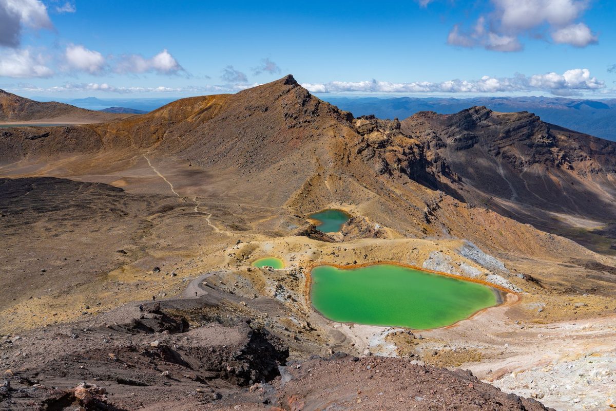
Past Soda Springs the track climbs about 350 m up a staircase to South Crater, then continues up to Red Crater itself, where loose volcanic scree and a steep, exposed ridge make for the trickiest footing on the whole route. From there it is a steep descent past the Emerald Lakes, along Blue Lake, and a long, knee-testing zigzag down through forest to the Ketetahi end. Mountain biking is not permitted anywhere on the track, and dogs are banned throughout Tongariro National Park, including in vehicles parked within the park boundary.
Cost, DOC booking and shuttle logistics
Lead-in: walking the crossing costs nothing beyond your own gear and transport; DOC’s track booking, introduced in October 2023, is free, takes a couple of minutes online, is recommended for every visitor but not mandatory, carries no penalty if you turn up without one, and has no cap on numbers, so it functions more as a communication tool than a rationing system; the real cost is the return shuttle, which runs roughly NZ$45 to 70 per adult in 2026 depending on which town you book from and which operator you use.
You need the booking to use a shuttle or a guided walk service, and operators will generally ask for your booking reference before they let you on the bus, so treat it as a practical requirement even though DOC frames it as optional. If you already hold a hut or campsite booking for the Tongariro Northern Circuit Great Walk, you are exempt from the separate crossing booking. There is no cost either way; DOC uses the data to send safety alerts directly to registered walkers, which matters more than it sounds given how quickly weather turns on this track.
Shuttle pricing depends heavily on where you start. Taupo-based operators typically charge more because of the extra driving distance (Taupo sits about 86.5 km from the Whakapapa end of the park), while shuttles picking up in Turangi or National Park Village run cheaper and get you to the trailhead faster. Booking through your hostel or accommodation the night before is common and usually gets you a small discount over walk-up booking. Private cars cannot use Mangatepopo car park during summer at all; it is shuttle drop-off and pick-up only, and this has been the case even before the 2025 fire damage tightened things further. There is a small private car park near the Ketetahi end if you have your own vehicle and can arrange a second car or a one-way shuttle back to it, but for most backpackers without their own transport, a return shuttle from Taupo or Turangi is simplest.
The route, section by section
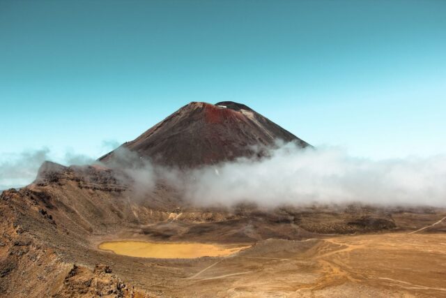
Mangatepopo to South Crater is the gentlest stretch and the one most people photograph least, because the drama is still to come. Boardwalk gives way to a gravel track climbing gently up the valley floor, with Mount Ngauruhoe (the cone most people recognise from film) looming to your right for most of it. Budget 1.5 to 2 hours here and use it to warm up rather than sprinting it, because the next section punishes anyone who arrives at the base of the staircase already tired.
The climb out of South Crater to Red Crater is the hardest physical section: a sustained, steep ascent on loose volcanic material with real exposure at the top. Red Crater itself, at 1,886 m, is where most people stop for photos, and where the wind chill difference from Taupo is most obvious. DOC’s own guidance is blunt about the risk here: loose rocks and stones on the steep slopes present a major slip hazard, and 38 percent of tramping injuries nationally come from slipping, so this is not the place to be checking your phone.
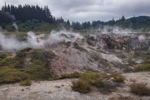
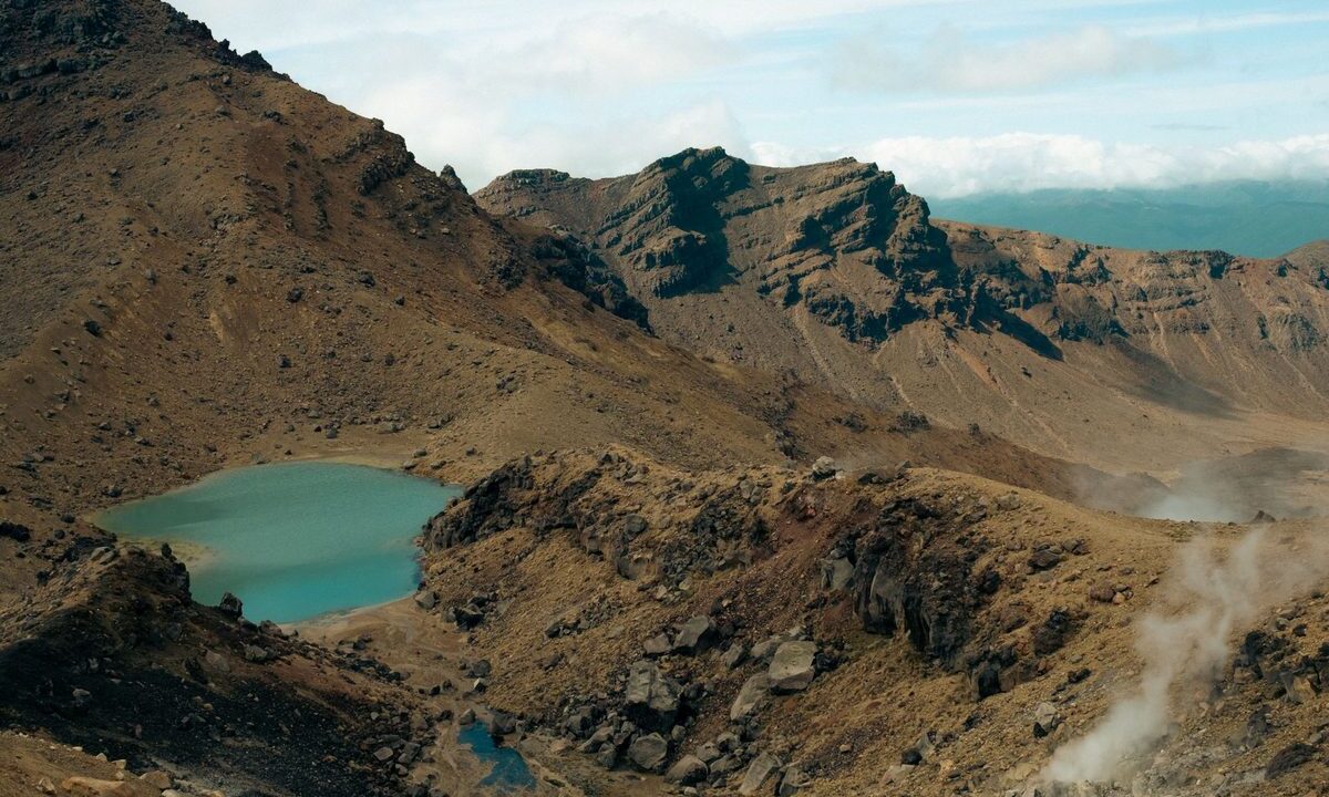
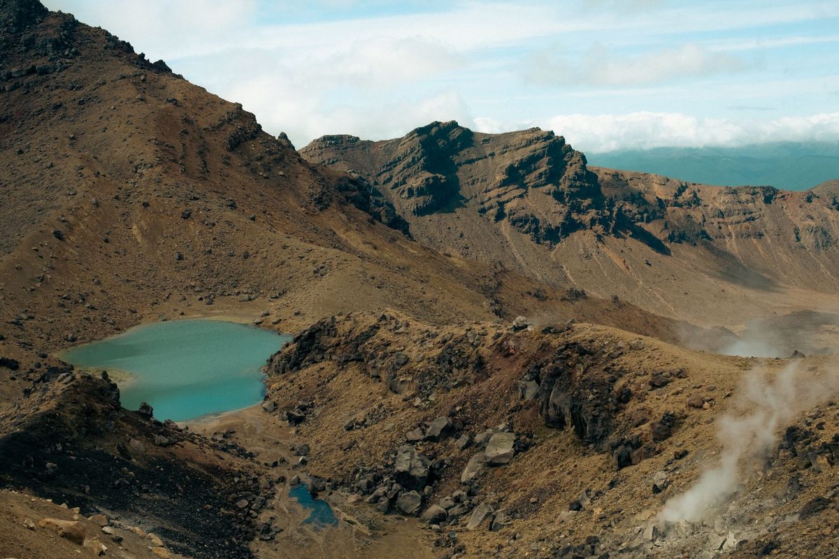
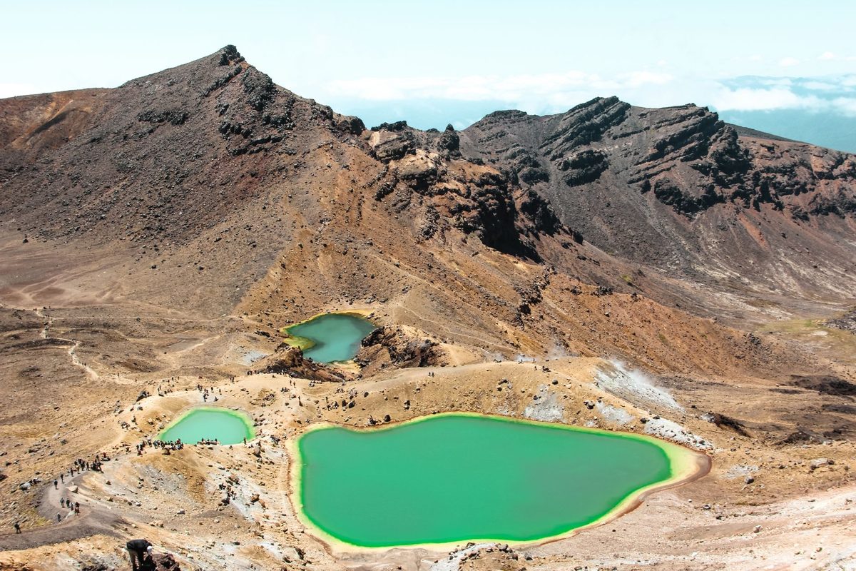
The descent past the Emerald Lakes (Nga Rotopounamu) is the section every photo of the crossing is taken from, and for good reason; the mineral colouring genuinely looks unreal in good light. Do not touch or enter the lakes, and stay off the geothermal ground around them; steam vents nearby are hot enough to burn and the ground can be unstable. From Blue Lake the track continues past Ketetahi and begins the long descent through native forest back to the road end, a stretch that is easy to underestimate because your legs are already tired and the switchbacks go on longer than they look on the map.
Fitness, difficulty and who should skip it
DOC rates the crossing as requiring high fitness with steep, undulating gradient, and that is not marketing caution. This is a 19.4 km day with 1,196 m of total elevation change on uneven, exposed, often crowded terrain, done in one push with no shortcuts once you are past Mangatepopo. If your longest recent walk was a flat 5 km, this will hurt, and being genuinely unfit is one of the more common reasons people call for rescue partway through.
DOC does not recommend the crossing for children under 10, and that applies regardless of how fit the child is, because the exposure and weather risk are the limiting factors, not stamina. If you are travelling with younger kids, the short, well-formed family-friendly alternatives around the park, like Taranaki Falls or Tama Lakes, deliver volcanic scenery without the alpine risk.
Honest verdict: if you have never done a full day on your feet on uneven ground, do a shorter warm-up hike first, ideally the free Craters of the Moon walkway or similar back in Taupo, before committing to this one. The crossing rewards preparation and punishes people who treat it as a casual add-on to a road trip.
Weather and when to go by season
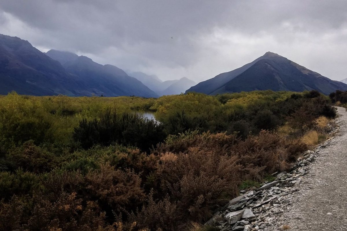
Lead-in: the crossing is walkable year-round, but the experience and the gear list change completely between the November to April summer season and the May to late October winter season, and DOC’s daily hazardous weather advisory only operates during summer, so winter walkers are on their own for judgement calls unless they book a guide.
Summer (November to April)
This is when the vast majority of backpackers walk the crossing, and it is when shuttles run their full timetable and the daily “Not Recommended Today” advisory system kicks in. DOC assesses conditions each morning at 6am against thresholds for wind speed, wind chill, and rainfall, and posts an advisory if the crossing is expected to be genuinely hazardous that day; check the regional weather guide the night before and again at breakfast. Even in summer, snow can fall at Red Crater with no warning, so the packing list below is not optional padding.
Winter (May to late October)
Covered in detail in the next section: this is a different trip requiring alpine equipment and skills, not a scaled-down version of the summer walk.
Shoulder weeks
Late April and early November sit in a genuine grey zone where conditions can swing either way within the same week. Book a shuttle with a flexible change policy if you are walking in these windows, and have a backup day in your itinerary in case the operator cancels on you. For a broader read on which months suit backpackers best across the whole region, not just this one track, see the best time to visit guide.
Doing it in winter: alpine skills or a guide
Lead-in: from May to late October, DOC’s guidance is unambiguous, you need alpine skills, equipment and experience to attempt the crossing unguided, including the ability to navigate when cloud or snow hides the marker poles, knowledge of where avalanches are likely, and the gear and competence to arrest a slide on icy terrain; shuttle buses generally stop running altogether, and guided trips include transport as part of the package.
The temperature swing alone catches people out. On a calm day, Red Crater sits at least 10°C colder than Taupo and 5°C colder than the Mangatepopo start, and every 10 km/h of wind subtracts roughly another 2°C of wind chill. DOC’s example: 10°C in Taupo can feel like minus 2°C at Red Crater with a moderate 20 km/h wind. Expect ice on the track from April through October, and treat a helmet, crampons and a properly used ice axe as essential rather than optional extras.
Avalanche terrain exists on sections of the winter route, and DOC’s advice is to carry a transceiver, probe and shovel and to actually know how to use them, not just own them. If that list already sounds like more than your trip budget or skill level covers, the honest move is to book a guided winter crossing rather than attempt it solo; several Tongariro-based operators run exactly this trip with all the technical gear included, and it is genuinely the safer and, once you price your own gear hire, often cheaper option.
The 2025 fire, the rahui and what’s changed
Two fires burned through an estimated 2,935 hectares of Tongariro National Park in November 2025, and the affected area sits right around the Mangatepopo start of the crossing. The crossing itself reopened at 9am on 17 November 2025 after DOC and Fire and Emergency confirmed it was safe, but the Mangatepopo Track, which forms part of the separate Tongariro Northern Circuit Great Walk, remained closed while the damage was assessed, and Mangatepopo Road and its car park suffered damage that pushed transport back to shuttle-only for a period.
Ngati Hikairo ki Tongariro, the hapu who hold guardianship over this maunga, placed a ten-year restorative rahui over the fire-affected area. Practically, that means staying strictly on the formed track, not stepping into blackened, off-track terrain even out of curiosity, cleaning your boots and gear before you arrive to avoid spreading weeds into a recovering ecosystem, and carrying every piece of rubbish back out with you. You will see scorch marks on the pou (carved post) at the Mangatepopo start and blackened ground in places; walking through it respectfully, rather than treating it as a photo backdrop, is what local iwi have specifically asked visitors to do.
Check current alerts before you travel, since fire-affected terrain can change access arrangements with little notice, and a local operator or the Tongariro National Park Visitor Centre will have the most current picture on any given week. This is one of the few facts in this guide worth re-verifying close to your travel date rather than trusting a screenshot from months earlier.
What’s overrated, and what to skip
What’s overrated
The idea that you need a premium guided tour to do this safely in summer is oversold by a lot of booking platforms. In good summer conditions, with the right gear and a shuttle booked, this is a well-marked, DOC-maintained track that thousands of unguided backpackers walk every week; a guide adds value mainly in winter or for people who want the cultural and geological commentary, not because the summer track itself is hard to navigate.
Photo package add-ons sold by some shuttle operators are also skippable for most backpackers; your own phone will get the Emerald Lakes shot just fine in decent light, and the marginal cost rarely matches the marginal value for a budget traveller.
What to skip
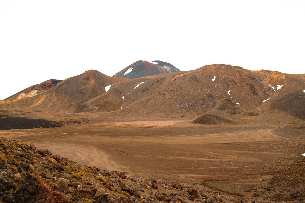
Skip attempting the summit of Ngauruhoe or Tongariro itself unless you specifically know what you are doing; local iwi ask visitors not to summit out of respect for the mountain’s sacred status, and DOC does not maintain or mark a summit route. Skip driving yourself to Mangatepopo expecting to park there in summer; the car park is shuttle and drop-off only, and turning up with your own car will just waste the first hour of your day. Skip starting after 9am in peak summer if you can help it; later starts mean walking the exposed Red Crater section in the most crowded window and finishing your descent as afternoon cloud typically builds.
Tongariro Alpine Crossing by traveller type
Solo backpackers
This is one of the more solo-friendly big hikes in New Zealand precisely because it is so heavily walked in summer; you are rarely alone on the track, shuttles are set up for single travellers, and hostels across Taupo’s backpacker scene routinely organise informal shuttle-sharing with other guests doing the same walk that week.
Families
Skip it with anyone under 10, per DOC’s own guidance, and think hard about it for kids under 14 unless they are strong, experienced walkers. The shorter alternatives inside the same national park deliver similar volcanic scenery at a fraction of the exposure.
Couples and groups
The most straightforward group to plan for. Book one shuttle for the group, agree a realistic pace before you start so nobody feels pressured to keep up on the Red Crater climb, and build in a slower half-day either side of the walk since most people are genuinely spent by the end.
A costed sample day
Lead-in: a typical summer crossing day from Taupo runs from a 5:30 to 6am shuttle pickup to a 4 to 5pm return, and the all-in cost for one adult, shuttle included, sits around NZ$60 to 85 for 2026 once you add lunch and a hot drink at the end.
Shuttle return from Taupo: NZ$45 to 70, booked the evening before through your accommodation or directly with an operator. Packed lunch and snacks bought the day before at a Taupo supermarket rather than a trailhead store: roughly NZ$10 to 15. A hot drink and proper meal back in town once the shuttle drops you: NZ$15 to 25 depending on where you eat, and after nine hours on your feet you will want the bigger, carb-heavy option over a light salad. No entry fee, no booking fee, no hut fee for a single-day crossing.
If you are travelling on a tight daily budget, this is genuinely one of the best value big-ticket days in the whole Taupo region: a full alpine experience for well under NZ$100 including food, when plenty of adventure activities back in town cost more for a fraction of the time outdoors.
Fitting the crossing into a wider Taupo trip
Most backpackers do not fly in purely for this one walk; it sits inside a wider loop around the region, and where you place it matters. Doing it on day two or three of a five-day itinerary gives your legs a rest day either side, which matters more than people expect given how much the descent hammers your knees. Doing it on day one is possible but leaves you sore for everything else that follows.
It is worth comparing what you are getting here against the region’s other big-ticket outdoor spends. A tandem skydive or a jet boat run costs roughly the same as this whole day once you add the shuttle, but delivers minutes rather than hours; if you are working through a list of adventure activities on a fixed budget, the crossing is the one that stretches furthest per dollar. It also pairs oddly well with a gentler geothermal day either side; walking past real steaming vents on the crossing gives you a different appreciation of the smaller, tamer geothermal attractions back in town, and vice versa.
If the crossing gets cancelled on you by weather, do not just write the day off. Several worthwhile day trips from Taupo make a solid backup plan, and swapping days rather than skipping the crossing entirely is almost always possible if you have flexibility built into your schedule. Whatever you do on the day, keep the broader regional safety guidance in mind, particularly around telling someone your plan and checking the forecast, since it applies just as much here as anywhere else in the park.
Frequently asked questions
How hard is the Tongariro Alpine Crossing for an average fitness level?
Hard but achievable for anyone who can comfortably walk for 7 to 9 hours over uneven, steep terrain. It is not a technical climb in summer, but the sustained ascent to Red Crater and the long descent afterward will genuinely tire an unfit walker, and DOC rates it as requiring high fitness for good reason.
Do you need to book the Tongariro Alpine Crossing in advance?
DOC’s own track booking is free and recommended but not compulsory, and there is no penalty for turning up unregistered. In practice, though, you need a booking reference to use a shuttle or guided service, and shuttle seats do sell out in peak summer weeks, so book both the DOC registration and your shuttle at least a few days ahead.
How much does the Tongariro Alpine Crossing cost in total?
Walking the track itself is free. The only real cost is the return shuttle, which runs roughly NZ$45 to 70 per adult in 2026 depending on your pickup town and operator, plus whatever you spend on food for the day. There is no entry fee, park fee or booking fee.
Can you do the Tongariro Alpine Crossing in winter without a guide?
DOC strongly discourages it unless you genuinely have alpine skills, equipment and experience, including ice axe and crampon competency and avalanche awareness. Shuttle services mostly stop running in winter, so most winter walkers use a guided operator who provides both the technical gear and the transport.
Is the Tongariro Alpine Crossing open after the 2025 fires?
Yes. The crossing reopened on 17 November 2025 after fire assessment confirmed it was safe, though the separate Mangatepopo Track (part of the Tongariro Northern Circuit) remained closed for longer, and a ten-year restorative rahui applies to the fire-affected area around the start. Check current DOC alerts close to your travel date, since access arrangements can still shift.
What should you pack for the Tongariro Alpine Crossing?
In summer: waterproof jacket and pants, warm layers, sturdy boots, sun protection, a head torch, and 2 to 3 litres of water since nothing along the track is drinkable. In winter, add crampons, an ice axe, a helmet, and avalanche safety gear, or book a guide who supplies them. The full general packing list covers the base layers worth owning before you arrive.
Final Thoughts
The Tongariro Alpine Crossing earns its reputation. Very few day walks anywhere put you on top of an active volcano, past three turquoise crater lakes, and back down through native forest in a single push, and the fact that it costs nothing beyond a shuttle fare makes it one of the best value days a backpacker can build into a Lake Taupo trip.
Treat the fitness requirement, the weather advisory and the winter warnings as real rather than marketing caution, because the terrain does not forgive people who arrive unprepared. Book your DOC registration and your shuttle ahead, check the advisory the morning of, and respect the rahui around the fire-affected ground near Mangatepopo.
Beyond the crossing itself, Tongariro National Park’s cultural and volcanic history runs deep; reading a little of the Ngati Tuwharetoa history behind these mountains before you go will change how you see the pou at the start and the request to leave the summits untouched.
Back to the main guide: for every other trail and walk around the region, see the full Hiking and Walks guide to Lake Taupo.