The Great Lake Walkway in Taupo is the flattest, easiest, and most-used piece of walking track in the district: a sealed path that runs along the town foreshore and out around the southern shoreline of Lake Taupo, free to walk any day of the year, with no fitness test attached. If you want lake views without a climb, this is it. It sits inside the broader hiking around Lake Taupo guide alongside the steeper stuff, but this one is the outlier: pushchair-friendly, dog-friendly, and doable in trainers.
What the Great Lake Walkway actually is
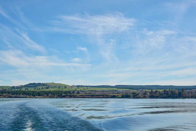
Locally it gets called a few different things. The council and tourism board list it as the Great Lake Pathway, some older signage and cyclists still call it Lion’s Walk, and plenty of visitors just call it the Great Lake Walkway or the lakefront track. All of these point at the same route: a sealed, shared-use path that starts at the Taupo Boat Harbour, where Redoubt Street meets Ferry Road, and runs 12.7 kilometres one way along the southern and western edge of Lake Taupo. It is not a loop. You walk or ride out, then either turn around and come back the way you came, or arrange a pickup at the far end.
The one mix-up worth clearing up before you plan around this: the Great Lake Walkway is not the Great Lake Trail. Similar name, completely different track. The Great Lake Trail is a 71-kilometre Grade 3 mountain biking and tramping network on the lake’s western shore, with sections that need a boat transfer and multi-day planning. The Great Lake Walkway is the in-town version: flat, paved, no technical skill needed, and walkable in normal shoes straight from your accommodation. If an operator or forum post is talking about shuttle bookings, boat transfers, or a multi-day itinerary, they mean the Trail, not this walk, and confusing the two is the single most common planning mistake visitors make.
Lead-in: the walkway is free with no entry gate or booking system, it is open 24 hours although walking it after dark away from the town lighting is not something we would recommend, the full one-way distance is 12.7 kilometres which takes about 2.5 hours to walk or 1.5 hours to cycle at an easy pace, the surface is sealed and flat the entire way with only a handful of gentle rises, and you can join or leave the path at multiple car parks along the route so you never have to commit to the whole distance if you do not want to.
The route, bay by bay
Starting at the Boat Harbour end, the path runs past the town centre foreshore first, close to the AC Baths, the main swimming beaches, and the motels that line Lake Terrace. This stretch is the busiest, especially on summer evenings when half the town seems to be out walking a dog or pushing a pram, and it is also the stretch with the best cafe access if you want to turn the walk into a coffee mission rather than a workout. For a rundown of where to eat along the way, the food and dining guide covers the cafes closest to the lakefront.
Past the town centre the path heads toward Wharewaka Point, roughly 3 kilometres from the Boat Harbour, which is the best single stop on the route. There is a children’s playground, a barbecue area, toilets, and open grass right on the water, close enough to make a there-and-back walk of under an hour if that is all the time you have. From Wharewaka the path continues past Two Mile Bay, at roughly the 5 kilometre mark, and Three Mile Bay, at roughly 8 kilometres, both of which have swimming spots, boat ramps, and noticeably quieter stretches of shoreline than the town end. The final few kilometres to the far end of the route see very little foot traffic at all, which suits anyone who wants the lake to themselves rather than a busy waterfront.
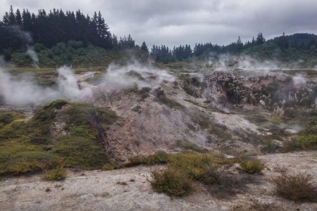
One detail most first-time visitors do not expect: parts of the shoreline along this route are geothermally warmed. There are a few spots, informally known among locals as hot water spots, where the sand itself is warm to the touch or where warm water seeps in near the shore. It is not a maintained pool like Taupo’s other geothermal attractions, more a quirky bonus if you happen to walk past on a cool morning and notice the sand feels wrong in a good way. A handful of interpretation panels along the route also cover the area’s Maori history, worth a slow read if you have the time rather than something to rush past.

Walking it versus cycling it
Both are common on this path and both work well, but they suit different trips. Walking the full 12.7 kilometres one way takes about two and a half hours at a normal pace, so a return walk is a genuine half-day commitment, around five hours including stops. Most walkers do not do the whole thing. They pick a target, usually Wharewaka Point or Two Mile Bay, walk out, sit by the water, and walk back, which turns into an hour or two rather than a full afternoon.
Cycling is the more efficient way to see the whole route. At an easy pace it takes about ninety minutes one way, so a return ride is roughly three hours including a stop for a swim. The path is graded 1, the easiest classification used in New Zealand, described as fairly flat with a smooth surface and no technical obstacles, which means hire bikes, e-bikes, and kids on training wheels all cope fine. It was voted New Zealand’s Favourite Urban Ride in 2017, and riding it in the early morning or late afternoon, when the light hits the lake and the path is quieter, makes it obvious why. Bike hire in town typically runs somewhere in the NZ$25 to 45 per half day range depending on whether you want a standard hybrid or an e-bike, and most shops are within a few minutes of the Boat Harbour start point. The adventure activities guide lists operators alongside the district’s other outdoor options.
The path is shared-use, meaning cyclists are expected to give way to pedestrians rather than the other way around, but on the busier town-end stretch it pays to walk on the left and keep an eye out regardless, because not every cyclist knows or follows that rule.

What’s overrated about it
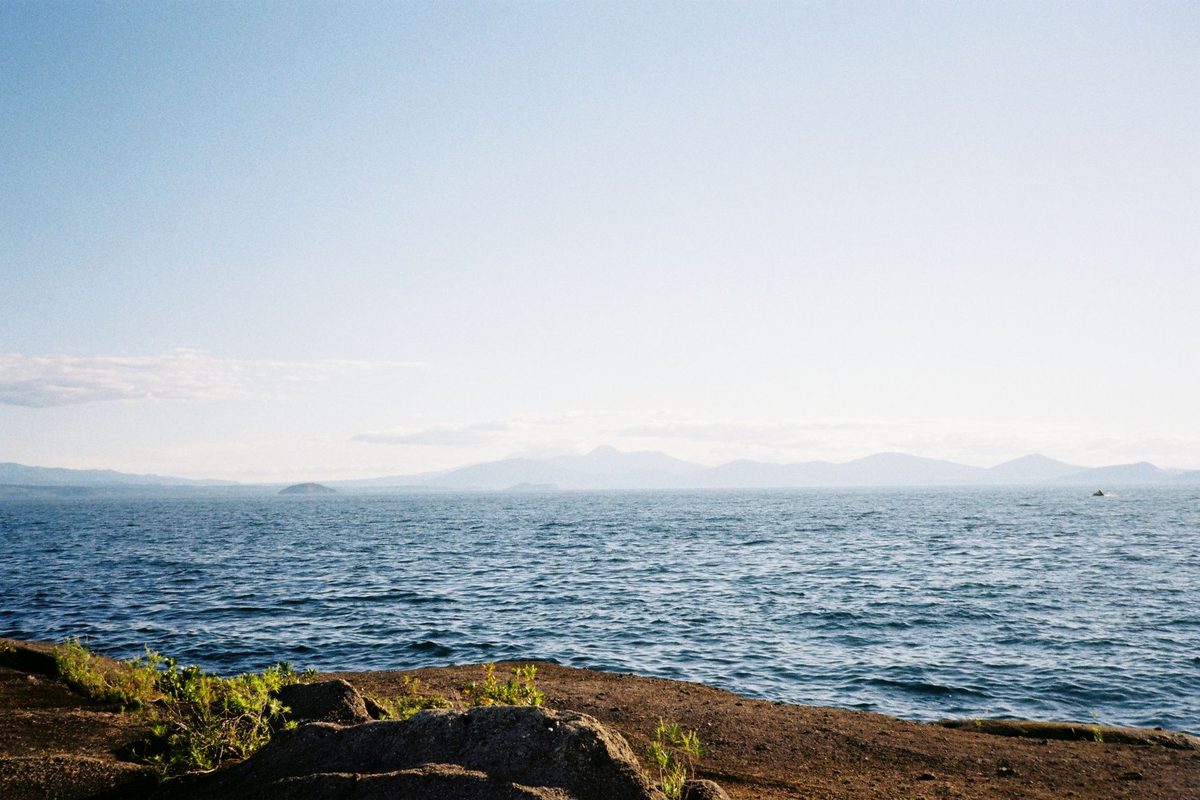
Doing the whole 12.7 kilometres one way, especially on a first visit, is the main thing we would talk you out of. The scenery does not change dramatically along the route. It is lake on one side, road or reserve on the other, the whole way, and the views toward Mt Ruapehu, Mt Tongariro and Mt Ngauruhoe that you get near the start are largely the same views you get near the end, just from a slightly different angle. Unless you are specifically training for distance or you want the exercise, walking the whole thing one way and back is more repetition than most visitors expect, and the 3 to 5 kilometre stretch out to Wharewaka Point or Two Mile Bay gives you almost the same experience in a fraction of the time.
The other overrated move is treating this as a must-do scenic highlight on the level of Taupo’s genuine must-do experiences. It is a genuinely pleasant, useful, free walk, and it is worth doing if you are in town for more than a day or two, but it is not a scenic drawcard the way Huka Falls or the geothermal walkways are. Go in with the right expectation, a pleasant flat stroll or ride with lake views, rather than expecting a standout Taupo experience, and you will not be disappointed.
What to skip
Skip walking it in the middle of a summer afternoon if you can help it. The path has very little shade for most of its length, and the sealed surface reflects heat, so a walk that feels easy at 8am can feel considerably harder at 2pm in January. Early morning or the two hours before sunset are both noticeably better, cooler and with softer light for photos.
Skip trying to combine this with a big pack. If you are walking between accommodation options or from a bus stop with full backpacking gear, the sealed surface and flat grade make it manageable, but it is not designed as a transport corridor and there is limited shade or shelter if the weather turns. It works far better as a leisure walk once your gear is dropped off than as a way of actually moving between places with your bags.
Photography and the best times of day
Sunrise and the hour before sunset are consistently the best times to bring a camera. The lake faces roughly east to south-east along most of the walkway, so early morning light comes across the water toward you, which is when the volcanic peaks to the south tend to be clearest before any afternoon cloud builds up around them. Evening works differently: the light comes from behind you, warming the township and the moored boats near the Boat Harbour, which is a better angle if you are more interested in the town than the mountains. Overcast days are not a write-off either. Flat light on Lake Taupo often produces a mirror-calm surface that a bright, sunny, breezy day rarely gives you, so do not assume a grey forecast means skip the walk.
The most photographed stretch is the section near the Boat Harbour looking south-west across the water, simply because it is the easiest to reach and the view opens up immediately rather than requiring a walk to earn it. If you want a less obvious shot, Wharewaka Point and Two Mile Bay both offer angles that most visitors never bother walking the extra twenty minutes to reach.

The Great Lake Walkway by traveller type
Backpackers and budget travellers
This is one of the best free things to do in Taupo on a tight daily budget, and it sits comfortably alongside the other free activities in Taupo if you are stretching a trip out. Most hostels in town sit within a few minutes’ walk of the path, so it costs nothing beyond your time, and it is a genuinely good way to fill a rest day between bigger hikes without spending anything.
Solo travellers
Solo walkers get a low-effort, sociable-but-not-forced environment here, since the path is used by enough locals and visitors that you never feel isolated, but nobody expects conversation either. It is also flat and well used enough to be a sensible solo evening walk, though the standard advice in the solo travel guide still applies: stick to the busier town-end stretch after dark rather than the quieter bays further out.
Families
This is the single best lakefront walk in Taupo for families, largely because of Wharewaka Point. The playground, the flat pushchair-friendly surface, and the swimming access at Two Mile and Three Mile Bay make it easy to turn a short walk into most of a morning without anyone needing to walk further than they want to. It pairs well with the wider advice in the Lake Taupo with kids guide.
Cyclists and mountain bikers
Road cyclists and casual riders get the most out of this path, since it rewards distance without demanding technical skill. If you came to Taupo for serious mountain biking, treat this as a warm-up or a rest-day spin rather than the main event, and look instead at the more technical trail networks the district is known for, which are a different and much more demanding proposition than anything on this route.

The Great Lake Walkway by season
Summer, December through February, is the busiest and hottest time to walk it. The path gets genuine foot and bike traffic on weekends, the swimming spots at Two Mile and Three Mile Bay are worth building time around, and shade is minimal, so early starts pay off. Check the Taupo weather guide before you go if you are planning a full return walk, since exposed sealed paths are unpleasant in the region’s occasional summer heat spikes.
Winter, June through August, is quieter and cooler, which for a flat exposed walk is often the more comfortable choice, not the worse one. Taupo’s winter days are frequently clear and cold rather than wet, and the views across the lake to the snow-capped peaks of Tongariro National Park are, if anything, better in winter than summer. June is the wettest month regionally with around 14 rain days, so a waterproof layer is worth carrying, but this is not a walk that gets rained out the way an exposed alpine track does; you can simply turn back early if it starts tipping down.
Shoulder seasons, spring and autumn, are the sweet spot for most visitors: fewer people, comfortable temperatures, and the Kowhai trees along parts of the route flowering in spring add some genuine seasonal colour that the path lacks the rest of the year. For planning a wider trip around these patterns, the best time to visit guide breaks down the trade-offs season by season.
A costed sample day around the walkway
Here is what a full but budget-conscious day looks like if you build it around the Great Lake Walkway rather than a paid activity. Morning: walk from a central hostel to Wharewaka Point and back, roughly 6 kilometres round trip, NZ$0. Late morning: coffee and a pastry at a lakefront cafe on the way back through town, NZ$8 to 12. Midday: swim at Two Mile Bay if you extended the walk that far, NZ$0, or a picnic lunch bought from a supermarket beforehand, NZ$8 to 10. Afternoon: hire a bike for two hours and ride the section you have not walked, NZ$25 to 35 depending on the operator. Evening: a budget-friendly dinner in town, NZ$18 to 25. Total for the day: roughly NZ$59 to 82, and that is with a paid bike hire included. Drop the bike hire and walk the whole thing instead and the day costs next to nothing beyond food, which is hard to beat anywhere else in Taupo.

Where the path actually ends
Very few visitors walk or ride all 12.7 kilometres to the far end, and that is worth knowing before you set an ambitious goal for the day. Past Three Mile Bay the path continues through quieter residential and reserve land before finishing near the western edge of town, without a dramatic landmark or lookout marking the finish. The reward for going the full distance is solitude and a steady, uninterrupted stretch of lakefront rather than a specific sight you would otherwise miss, so if your main goal is scenery and photos, the first 5 to 8 kilometres genuinely deliver most of what the full route offers. Treat the far end as something for a good-weather day when you specifically want the exercise, not as an essential stop.
Getting there and practical details
The Boat Harbour start point, at the corner of Redoubt Street and Ferry Road, is about a 5 to 10 minute walk from most central Taupo accommodation, so a car is rarely necessary if you are staying in town. If you are staying further out or want to start from a different point, there is parking available at multiple spots along the route, including near Wharewaka Point and at Two Mile and Three Mile Bay, so you can start and finish wherever suits your day. There is no public transport running the length of the path itself; it is designed to be walked, ridden, or accessed by car at intervals, not served by a bus route. If you have just arrived in Taupo and are working out your wider transport options, the transport guide covers how to get into town in the first place.
Dogs are permitted along the path, though keep them on a lead near the busier town stretch and around the playground at Wharewaka Point. Toilets are available in the bays along the route, which matters more than it sounds like it should on a walk with limited other facilities. There is no charge, no booking, and no seasonal closure; it is open every day of the year, which is more than you can say for most of the district’s paid attractions.
Safety and comfort tips
Sun exposure is the main practical risk on this walk, not terrain or navigation. New Zealand’s UV levels run high even on mild-looking days, so sunscreen, a hat, and water are worth carrying for anything beyond a short stroll, especially in summer. The general safety tips for Lake Taupo apply here as much as anywhere: tell someone your rough plan if you are walking solo toward the quieter far end, and do not swim at the informal hot water spots without checking the water is not uncomfortably hot, since geothermal warming is not evenly distributed and can vary from pleasantly warm to genuinely hot within a few metres.
If you are backpacking through and this is one stop among many, pack light for the walk itself. A day pack with water, sunscreen, and a light layer is all this route needs; leave the full pack at your accommodation. For advice on what to actually bring to Taupo in general, the packing list guide covers the wider trip, not just this walk.
Combining the walk with a longer stay
If you are working from a full Lake Taupo trip plan rather than a single overnight, this walk is worth building in early rather than saving for last, since it is a useful way to get your bearings on the town’s layout, the accommodation strip, and the swimming spots before you commit time to bigger activities. It also works as a low-key first outing if you have just arrived and want to stretch your legs after a bus or drive without diving straight into a paid activity, which is a pattern covered in more depth in the general backpacking Lake Taupo guide.
For travellers with a car or a booked shuttle, several worthwhile day trips from Taupo start from roads that run parallel to sections of this path, so it is easy to combine an early lakefront walk with an afternoon further afield rather than treating the two as separate days.
How it fits into a wider Taupo itinerary
If you are only in Taupo for a short stint, this walk earns its place on a rest day or a half-day between bigger commitments like the Tongariro Alpine Crossing or a fishing charter. It costs nothing, needs no booking, and can be shortened or extended on the fly depending on how the rest of your day is going. Backpackers following a set route through the district, whether that is a 3-day Taupo itinerary or something longer, tend to slot it in on the first or last morning, since it does not compete for time with the region’s bigger draws and works well as a gentle way to end a trip that has otherwise been full of steeper walks and paid activities. It also connects well with a look at Lake Taupo’s history and Maori culture, since several interpretation panels along the route touch on the area’s significance, and with the wider things to do in Taupo guide if you are still building out your plan.
For travellers deciding where to base themselves, proximity to this walkway is a reasonable factor to weigh; several options covered in the where to stay in Taupo guide sit within a few minutes of the Boat Harbour start point, which makes an early or late walk genuinely convenient rather than something you have to plan a trip around.
Frequently asked questions
Is the Great Lake Walkway in Taupo free?
Yes. There is no entry fee, no booking system, and no gate. The path is open 24 hours a day, every day of the year, though walking the quieter far end after dark is not recommended.
How long is the Great Lake Walkway?
It runs 12.7 kilometres one way from the Taupo Boat Harbour along the southern and western shoreline. Walking the full distance one way takes about 2.5 hours, and cycling it takes about 1.5 hours. It is not a loop, so a return trip roughly doubles those times.
Is the Great Lake Walkway the same as the Great Lake Trail?
No, and this is the most common mix-up. The Great Lake Walkway, also called the Great Lake Pathway or Lion’s Walk, is the easy 12.7 kilometre sealed lakefront path in town. The Great Lake Trail is a separate, much longer 71 kilometre Grade 3 mountain biking and tramping network on the lake’s western shore that requires boat transfers and multi-day planning.
Can you cycle the Great Lake Walkway?
Yes, and cycling is the more efficient way to see the whole route, taking about 1.5 hours one way at an easy pace. The path is Grade 1, the easiest classification, flat and sealed the entire way, and it was voted New Zealand’s Favourite Urban Ride in 2017. Bike hire is available in Taupo town, typically NZ$25 to 45 for a half day.
Is the Great Lake Walkway suitable for young children or pushchairs?
Yes. The surface is sealed and flat throughout, and Wharewaka Point, about 3 kilometres from the Boat Harbour, has a playground, barbecue area, and toilets, making it a practical target for a family walk without committing to the full distance.
Do you need a car to walk the Great Lake Walkway?
No. The Boat Harbour start point is a 5 to 10 minute walk from most central Taupo accommodation. Parking is available at several points along the route if you do want to drive to a specific bay, but there is no public transport running the length of the path itself.
Final Thoughts
The Great Lake Walkway is not going to be the highlight of your Taupo trip, and it does not need to be. What it does well is give you a free, flat, reliable way to see the lake up close, any day, any budget, no booking required. Walk the short stretch to Wharewaka Point if you have an hour, ride the whole thing if you have half a day and want the exercise, or just use it as the easy option on a day when your legs are tired from something steeper the day before. It is one of the few things in Taupo that costs nothing and rarely disappoints, precisely because it does not try to be more than it is.
Back to the main guide: for the full range of trails around the lake, from this easy lakefront stroll to the multi-day Tongariro Northern Circuit, see the complete hiking and walks guide to Lake Taupo.